
The southernmost, westernmost and smallest of the Canary Islands is El Hierro, a protected volcanic island, declared a Unesco Geopark in 2014, with a bizarre inverted Y shape.
Just 50 kilometres long and with 100 kilometres of rugged coastline, caves and natural lagoons, such as Charco Manso or El Charco Azul, El Hierro is an ideal destination not only for sea and surf lovers but also for mountain bikers, paragliders and hikers.
The island is rich in contrasts and the landscape encompasses fertile land covered with vineyards, pine forests in the central area, subtropical fauna in the north-east, volcanic formations in the south and arid areas in Lajiales.
The island has many sandy beaches, hidden coves of difficult access and natural saltwater pools of unique beauty such as Pozo de Las Calcosas, on the coast of El Mocanal, or Tacoron, near La Restinga, and generally along the coast of the El Golfo valley. The beaches of Timijiraque, Playa de Las Arenas Blancas, Playa Miguel and La Restinga are very beautiful.
The wealth of marine life in El Hierro is exceptional and it is a popular destination for divers from all over the world. El Hierro’s climate is characterised by a perennial spring and is influenced by its proximity to the tropics and the trade winds.

El Golfo is one of El Hierro’s 3 volcanic structures and is located along the northern coast of the island. Only the semi-circular emerged part of the volcanic cone is visible, stretching from Salmor Roques in the east to Punta Arenas Blancas in the west and encompassing the fertile El Golfo valley, while the submerged part forms the wide bay in front of it.
Formed about 15 thousand years ago, El Golfo is 19 kilometres wide and has a maximum height of 1,500 metres above sea level at Malpaso. For a splendid view of El Golfo reach the Mirador de la Pena, a lookout point built on the north-eastern slope of the volcanic crater designed by Lanzarote-born artist Cesar Manrique.
The fertile valley of El Golfo, the island’s main agricultural area, is crossed by the road connecting the municipalities of El Pinar and La Frontera, while the capital Valverde is located on the northeast face of the crater.
The most famous path in El Hierro is the Camino de Janama, a spectacular route that winds along the rim of the El Golfo crater in the central part of the island.
Four and a half kilometres long, the path, bordered by low walls and illuminated, starts near the hermitage of La Caridad at an altitude of 1,230 metres and reaches the square and church of La Candelaria in the village of La Frontera. Panoramic views of the valley, planted with vineyards, banana trees and anans, and verdant nature will accompany you during this walk.
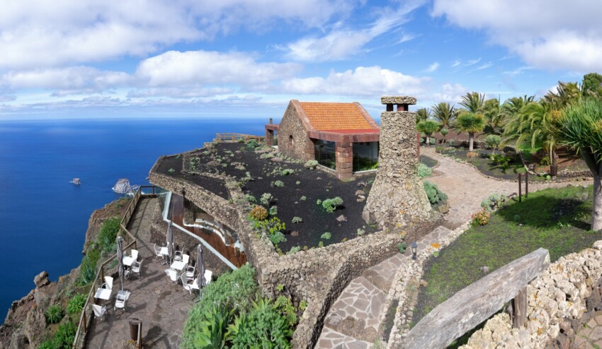
El Mirador de La Pena was designed by Lanzarote architect and artist Cesar Manrique and is located in the north-eastern part of El Hierro, at the northern end of the large semi-submerged crater of El Golfo, 740 metres above sea level.
Built of stone and wood, El Mirador is a good example of the island’s traditional architecture and provides a unique view of the lush valley below, the Roques de Salmor, Punta Grande and the surrounding mountains.
In addition to having parking spaces and toilet facilities, the Mirador is served by an excellent panoramic restaurant.
The Mirador de la Peña has been declared an Asset of Cultural Interest and is, without a doubt, a must-see for anyone visiting El Hierro. Not far away are also the junipers of El Sabinar, a kind of natural sculpture park.
To reach the Mirador de la Peña, simply take the road from Valverde to La Frontera through El Mocanal and, once you have passed the village of Guarazoca, turn right and follow the signs.

The town of Valverde is the capital of El Hierro and is located in the north-eastern part of the island.
Quiet and charming, Valverde sits on a hill about 600 metres above sea level, surrounded by lush vegetation, from where breathtaking views can be enjoyed.
With typical Canarian architecture, the town is criss-crossed by steep streets and is divided into three districts: Tesine in the upper part, La Calle and El Cabo in the lower part.
Not far from Valverde are the beautiful beaches of Playa Port Stake, Charco Manso, Tamaduste and Playa de las Playas.

The small coastal village of Tamaduste lies along the northern tip of El Hierro not far from the island’s capital Valverde and only 3 kilometres from El Hierro Airport.
This charming, quiet and cosy fishing village is surrounded by magnificent nature and is an ideal place for those who love hiking, the sea and relaxation.
The small black sand beach of volcanic origin of Playa Tamaduste, surrounded amphitheatrically by whitewashed houses, is protected from the winds and therefore suitable for families.
This small beach resort is very popular with the islanders.

Puerto de La Estaca is the main port of the island of El Hierro where all passenger ships dock. The harbour is located 7 kilometres south of the town of Valverde, the only one of the Canary Island capitals that is not on the sea, and the airport of El Hierro.
Around the port is a small town and the beach of Varadero.
The Fred Olsen shipping company offers connections between Los Cristianos in Tenerife and El Hierro. Boats every day except Saturdays reach El Hierro at 12.30 p.m. and leave at 4 p.m.
The company Naviera Armas connects El Hierro twice a week with Tenerife and once a week with La Palma and La Gomera.

The fishing village of La Restiga is located in the southernmost part of the island of El Hierro, within the Mar de las Calmas Marine Reserve, and is famous among diving enthusiasts for its numerous diving centres open all year round.
La Restinga is the ideal setting for a relaxing holiday. Although there are no actual hotels, the tourist offer of La Restiga, the southernmost point of the entire Canary Islands archipelago, is catered for by flats for rent, albeit in limited numbers. Bars and restaurants are mostly located on the promenade.
A small beach of black sand lies beside the small harbour where fishermen’s boats are moored. Not far away are the Cueva de Don Justo, Cala de Tacoron and the Mirador de Tanajara.
To reach La Restiga you must follow the road that passes through the villages of San Andres and Taibique.

The village of La Frontera is located in the central-western part of El Hierro, in the valley of El Golfo, and is one of the island’s three municipalities.
The beautiful natural pools of El Charco Sargos, Playa del Verodal and La Restinga, in the bay of El Golfo, are just some of the wonderful beaches in the vicinity of La Frontera.
Don’t miss the Mirador de Bascos, above Playa de las Arenas Blancas, a vantage point from which to admire some of the most beautiful views of the island and the semi-submerged crater, Punta de la Orchilla, a lighthouse built in 1924, and the hermitage of the Virgen de los Reyes in La Dehesa.
The municipality of La Frontera also includes the villages of Tigaday, Los Llanillos, Toes and Sabinosa.

El Sabinar of El Hierro is a juniper forest located on the west side of the island. Its main characteristic is that it is located in a remote and isolated position, although it is accessible by a paved road that only becomes unpaved for the last kilometre. Once you reach your destination, you will be astonished to see huge centuries-old junipers completely bent by the wind, a sign that in these parts nature rules and makes its voice heard loudly.
From here you can also set off on foot to explore the area, following a path that passes through more bent junipers, reminiscent of the forests of fairy tales: it seems that in El Hierro they are real, and you will be able to realise this on a simple walk for all ages around exceptional vegetation.
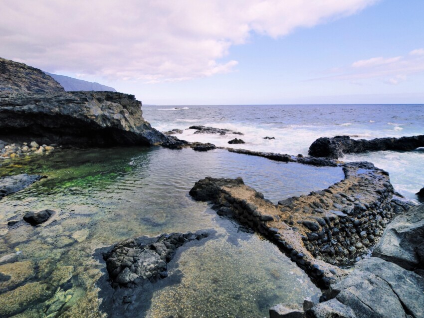
Charco Azul is undoubtedly one of the most spectacular places in El Hierro. It is a natural pool protected from the waves, surrounded by volcanic scenery. This pool is one of the best examples of some of the delicate side effects of volcanic flows.
Easy to walk to, with wooden bridges and a basalt arch crowning the pool, there are also diving spots for the more daring visitors.
The Mirador de Isora is located one kilometre beyond the village of Isora, in the central eastern part of the island of El Hierro, and is one of the island’s most impressive viewpoints, allowing you to admire the gulf below and the surrounding area, famous for its great natural beauty, from a considerable height.
At the foot of the Mirador de Isora, located at the edge of the El Risco de los Herreños mountain range at an altitude of 800 metres above sea level, are the breathtaking beaches of Las Playas and the fascinating rock formation Roque de la Bonanza.
The traditional village of Mocanal is located 700 metres above sea level in the northern part of El Hierro and is surrounded by farmland and a rugged coastline characterised by steep cliffs overlooking the Atlantic Ocean.
This rural village, an ideal place to relax and discover the island’s traditions, is located a short distance from the natural swimming pools of Pozo de las Calcosas, ideal for children’s swimming.
El Mocanal is just a 5-minute drive from the island’s capital Valverde and 15 minutes from La Frontera, El Hierro Airport and Puerto de la Estaca.
El Pinar is the smallest municipality in El Hierro and is located in the southern part of the island. It is nestled in an environment of rare beauty, set in a mountainous volcanic landscape.
Along the streets of the village are numerous shops and workshops of basket weavers, weavers and carvers.
El Pinar is an ideal place for lovers of hiking, climbing and walking. A footpath leads to the Faro de Orchilla, the westernmost point in Spain, while to reach the beautiful beaches near El Pinar, part of the coastline from Punta de la Restinga to Las Calmas, one has to travel by car. Las Casas, Tacoron and La Restinga will captivate you with their beauty.
Don’t miss El Lajial, a place where you can admire several unique volcanic formations, and El Julan, one of the most important archaeological sites in the Canary Islands archipelago.
The Mar de las Calmas Marine Reserve is located near the town of La Restringa. Due to the shape of the island, the area is usually protected from the winds, creating a rich ecosystem in its own right.
It is a popular area for divers, who must, however, follow some important rules and restrictions. It is also possible to swim in these waters, as long as the limit of people present is not reached.
In the following map you can see the location of the main places of interest mentioned in this article.
 Hotel
Hotel  Budget accommodations
  Apartments
  Family Hotel
 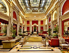 Luxury Hotel
 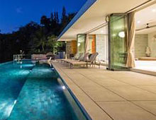 Resorts